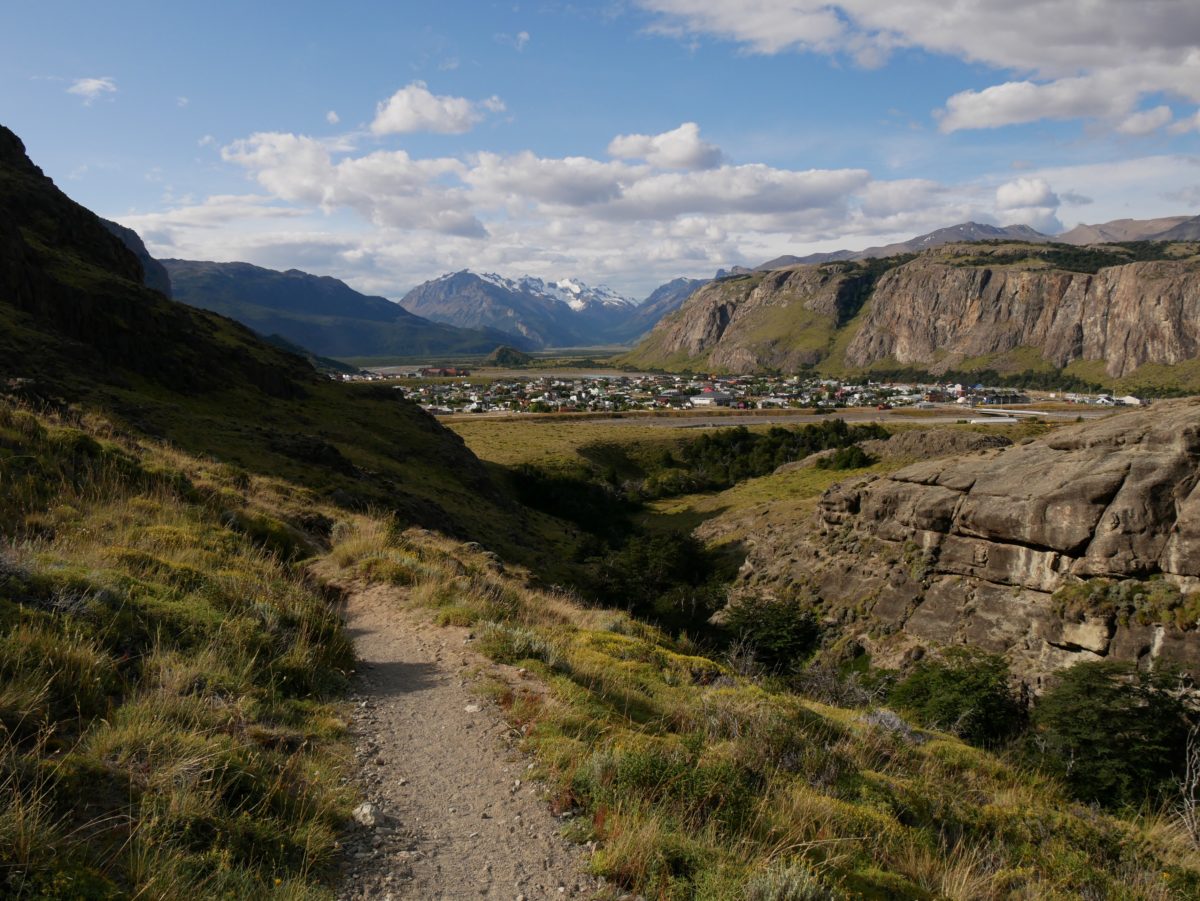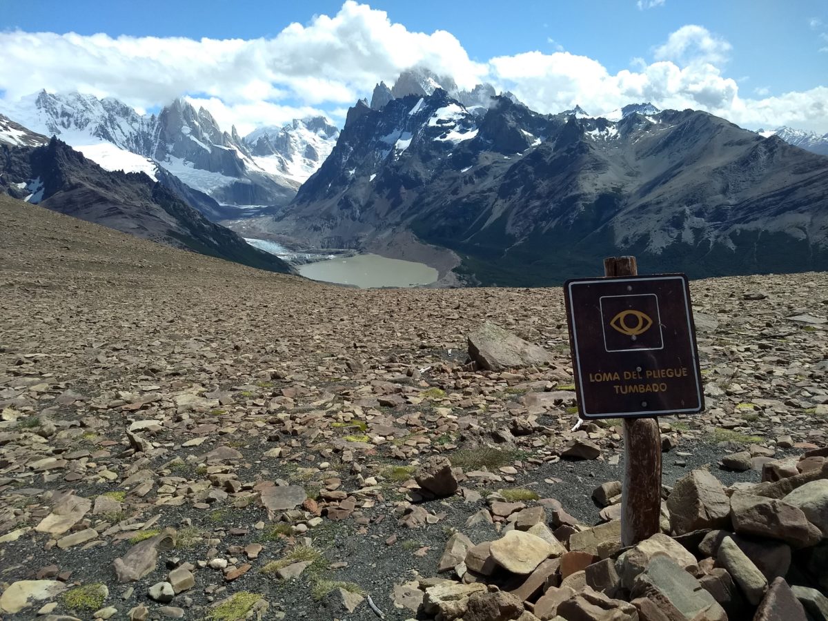
The Loma del Pliegue Tumbado Trail is a good weather trail. It is 10km (one-way) in distance and overcomes 1000 meters of altitude difference. The Loma del Pliegue Tumbado starts at the southern end of the city next to the visitor center. This is also where the Los Conores and Las Aquilas Trail starts.
You start at the fork to the right. For the first few kilometers it is the same way as to Laguna Toro (if you want to go to Laguna Toro (not to be confused with Laguna Torre) you have to register at the Visitor Center). The path goes up continuously, but not too steeply. Unfortunately, unlike the other main trails, the trail has no kilometer markings. So here you don’t know how much you have already done or still have to do. Except for a creek at the start there is no water for the next kilometers.
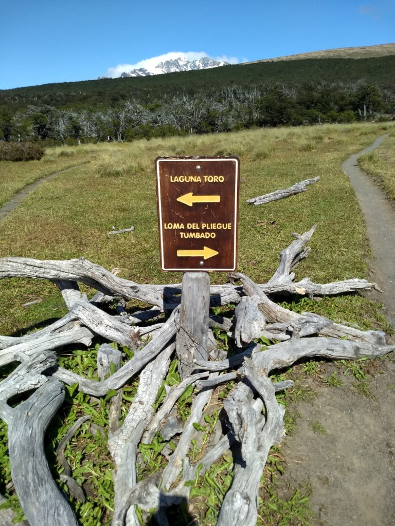
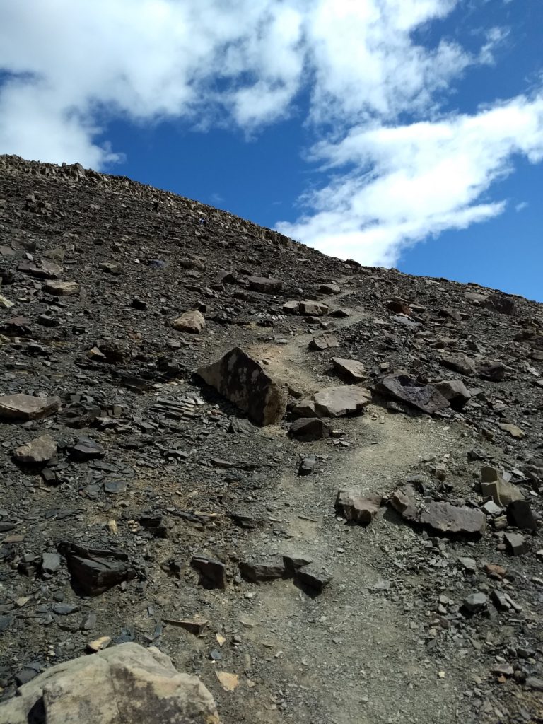
After about 4km the trail splits and the trail to Laguna Toro goes to the left, while you turn right to Loma del Pliegue Tumbado. A few hundred meters later you will come to a small stream and the first possible water refill. Afterwards you continue up through a forest. When you come out of the forest you have to walk another 1h over stones to the top. Here you will find another watercourse on the way.
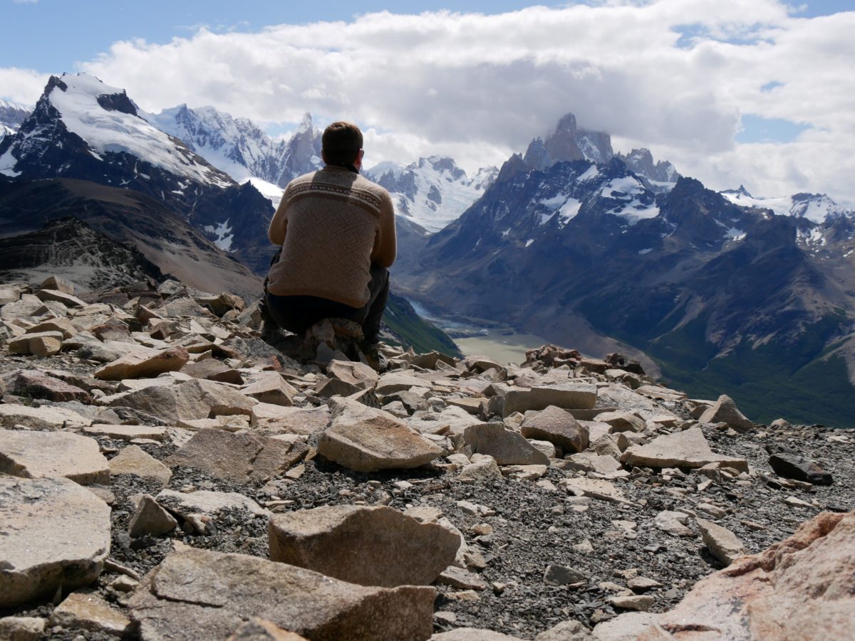
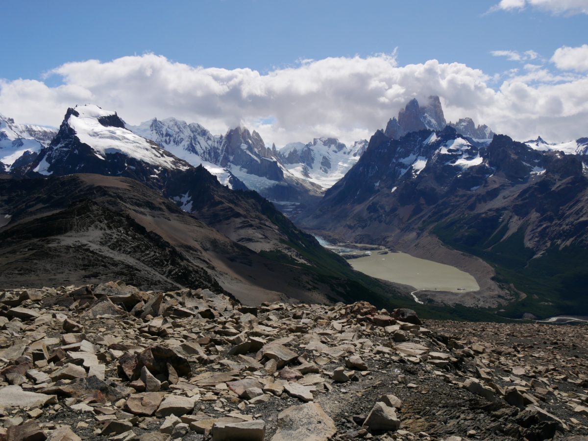
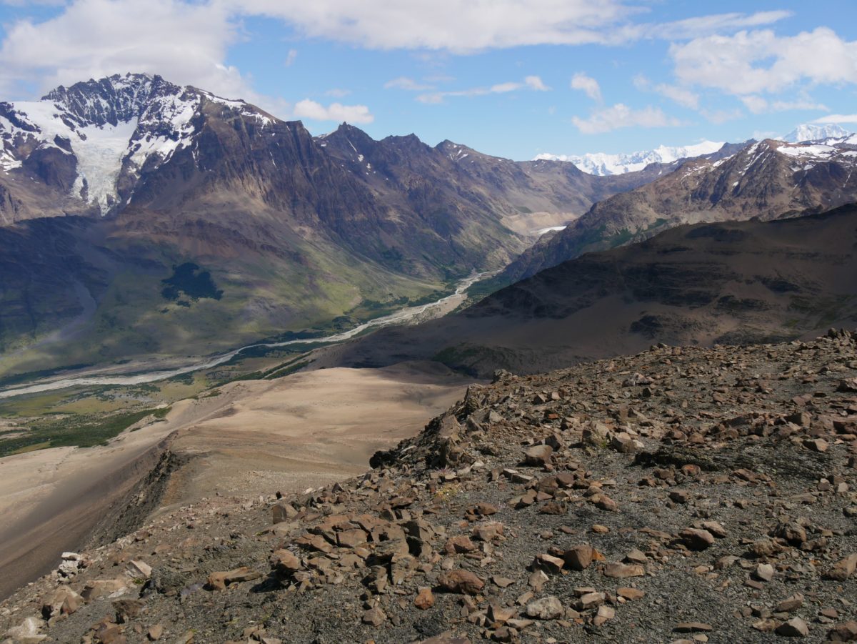
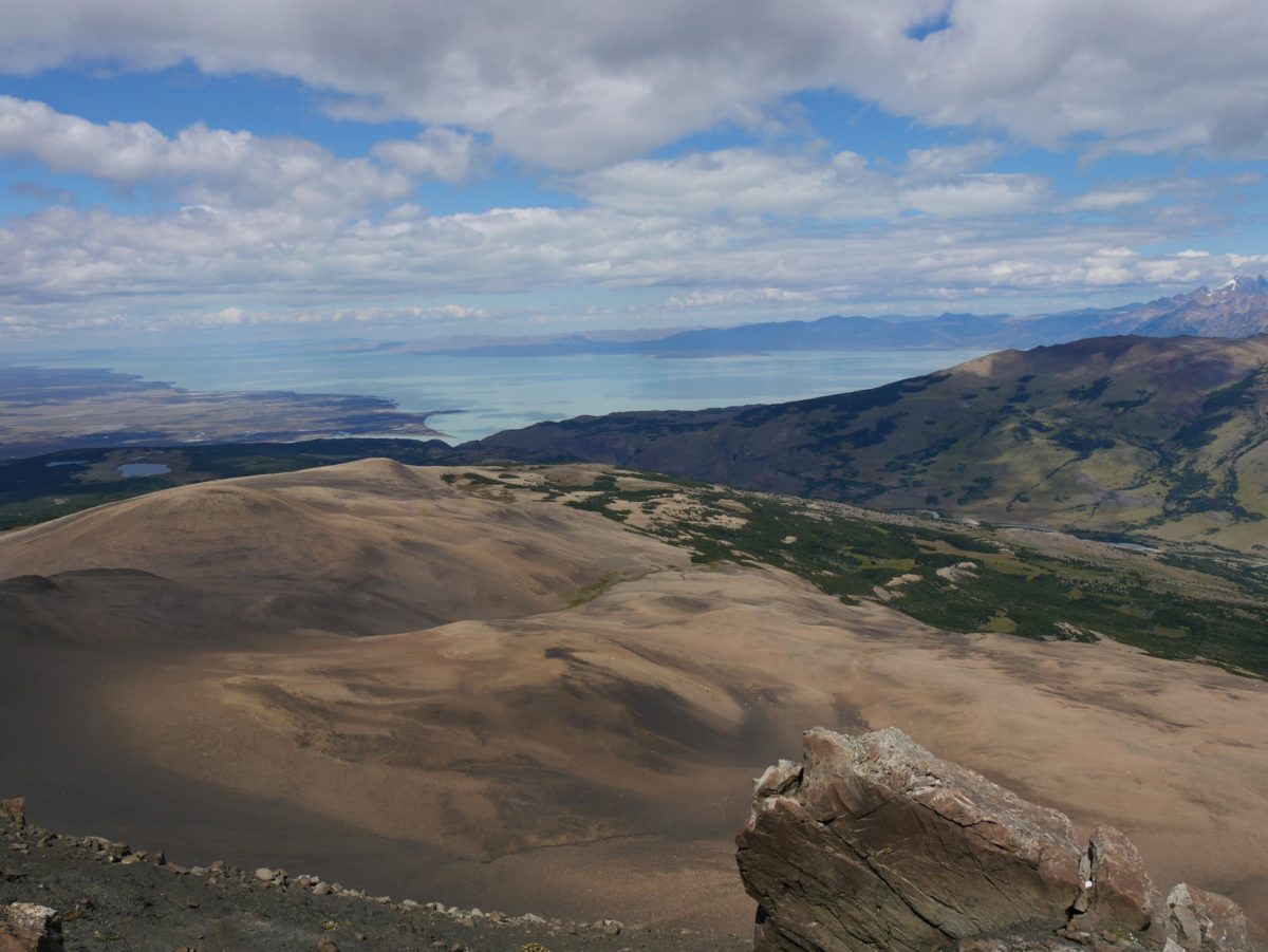
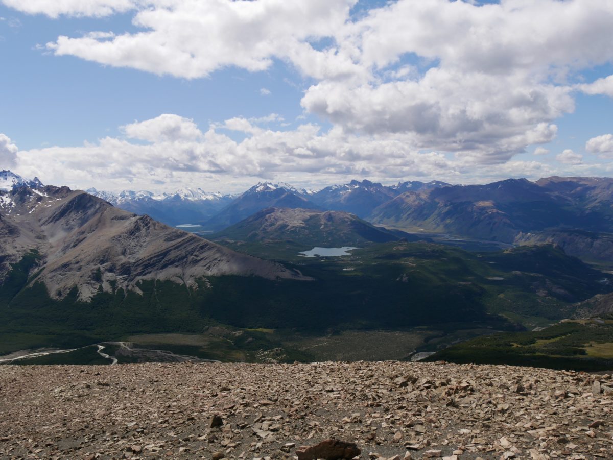
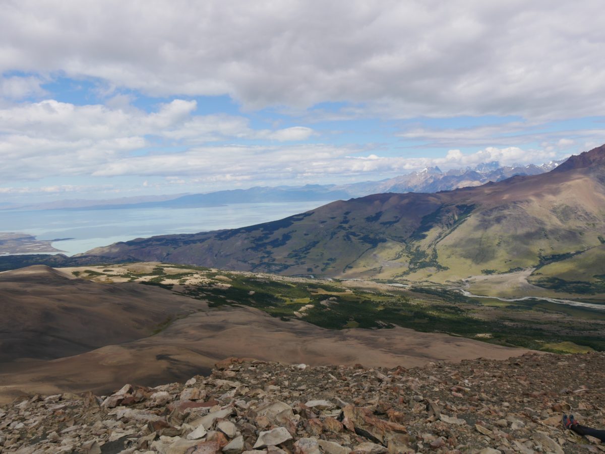
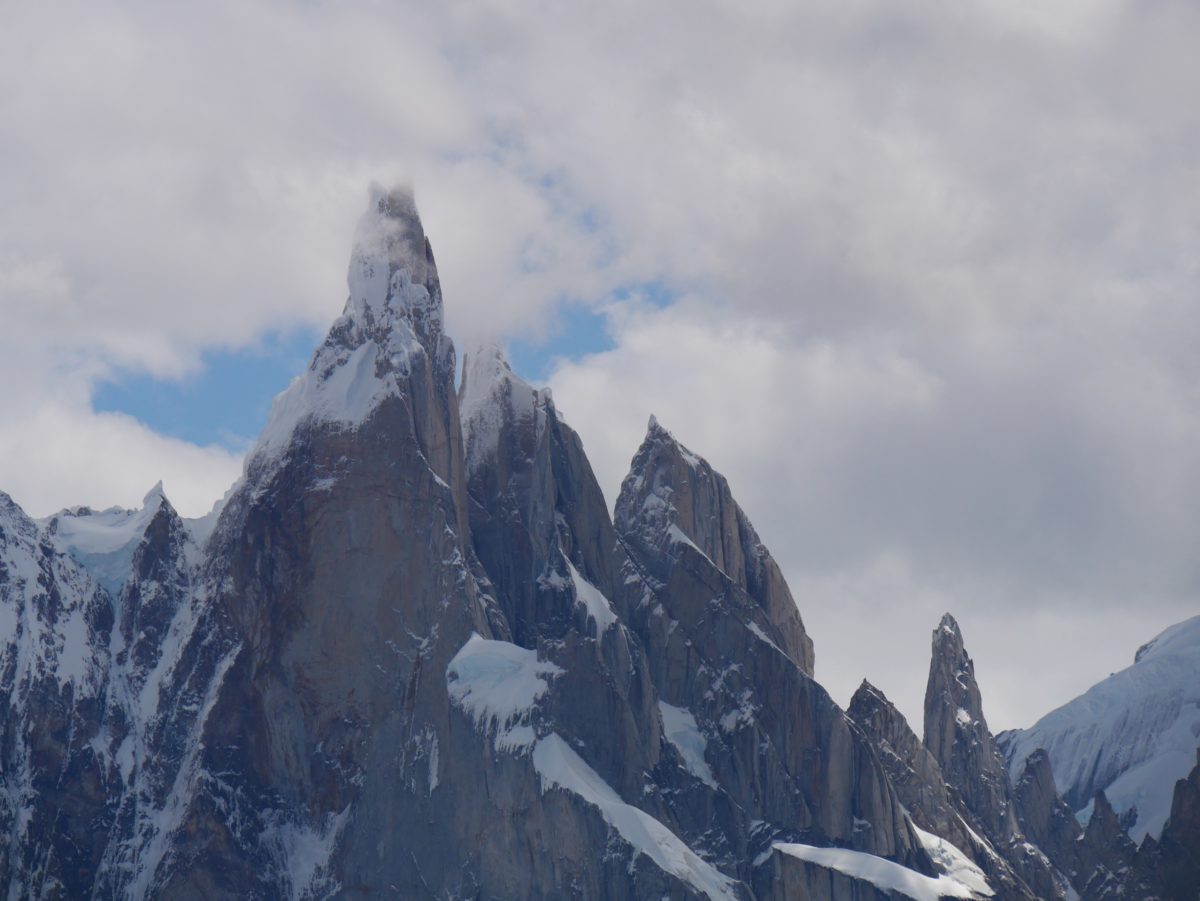
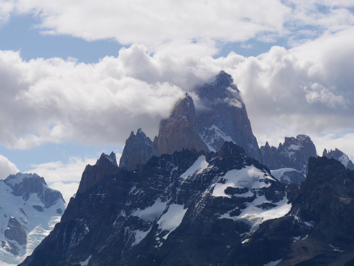
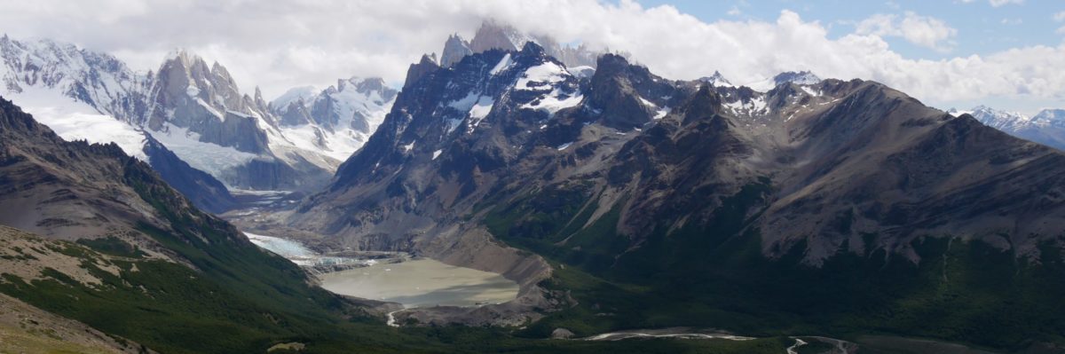
Halfway up on the stones you have the first viewpoint. If you climb to the top, you have a wonderful panoramic view. Attention, the last meters of the ascent are very steep. From the summit, you will see nearly everything. On one side, the steppe and the Lago Viedma. On the other side the Laguna Torre, the Cerro Torre, the Fitz Roy and the Laguna Capri. You will go back the same way as you came.
The Loma del Pliegue Tumbado overcomes more altitude meters than the other trails. But because of the continuous ascent it is not too hard and in my opinion easier than the Fitz Roy Trail. In bad weather there is nothing to see here at all, so the Pliegue Tumbado Trail is only suitable in good weather.